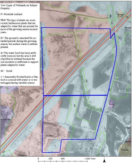
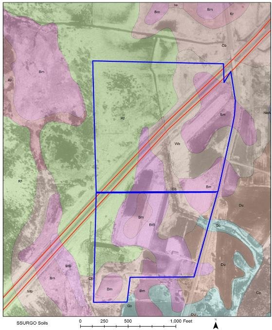
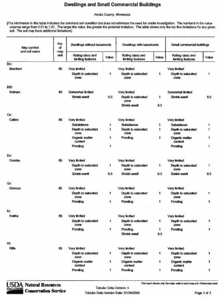
We have implemented the use of Geographic Information Systems (GIS) in our appraisal reports when applicable or requested. The use of GIS illustrates specifics of the property on a map such as: elevations, soil types, wetland areas/wetland types, and other property-specific attributes. All mapped attributes are fully explained within the appraisal report. All mapping and data used for explanation are acquired by the USGS, Minnesota DNR, or other reliable entities.